True Elevation
The South Central Region practices the concept of True Elevation (TE) to better represent segments in relation to surroundings / ground level. In general, most segments should have an elevation of Ground unless they pass over another segment, waterway, or natural feature. Drivable and non-drivable segments are handled the same way with respect to elevation.
NOTE: At this time, this is not a seek-and-destroy mission. Only fix true elevation as you encounter it.
True Elevation can help the user identify an elevated segment by shading the edges of the segment. Currently, not all elevated segments are configured to display this. At this time, true elevation only affects the look of the map in the LiveMap. However, it is anticipated the Waze app will render elevated segments in the future.
Definitions 
- Bridge: A bridge is defined as a segment which is elevated above ground level by means of a man-made structure, typically to pass over another segment, waterway/body of water, or a ground-level natural feature. This does not include segments which are elevated above surrounding ground level solely by earthen construction.
- Tunnel: A tunnel is defined as a segment which passes below ground level (i.e., underground) by means of a man-made structure. This includes segments which pass under ground level segments via the use of a culvert or similar structure. This does not include segments which are below surrounding ground level but above ground (e.g., depressed freeways).
Examples 
- Simple Interchange
- More Complex Interchange (requiring junctioning of ramp segments to maintain ground elevation)
- Turbine Interchange - Amarillo, TX
- Complex Interchange (High-Five in Dallas, TX)
- Raised Freeway (over marsh land)
Visuals 
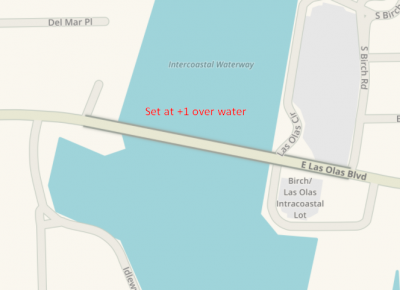
Below are two images showing the difference in Live Map rendering when True Elevation is not applied and when True Elevation is applied. Take note of the shading along the edge of the segment is missing when True Elevation is not used.
 |
 |
|---|---|
| Segment over water without True Elevation | Segment over water with True Elevation |
Implementation 
- Any segment that intersects another segment at the same elevation must have a junction node.
- Elevation of overlapping segments should be set relative to each other, with the lowest segment as Ground except when the lowest segment is a tunnel.
- Only elevate / lower the actual bridge / tunnel section of the road.
- Bridges should be cut at the start / end of the bridge where the land falls away. You can typically see guardrail at the start / end of the bridge section, an expansion gap in the pavement where the bridge starts / ends, and/or a pavement change (asphalt to concrete, for example).
- Careful attention needs to be paid if a potential segment cut will occur within a very short distance of an existing node.
- If your new node would be placed within a few dozen feet of an existing node, you can either use the existing node as one end of the bridge, or, if desired, add the node for the elevation change and then add a junction box.
- If you are unsure which of the above methods is preferable in a given situation, please contact local leadership.
- Maintain some uniformity for display purposes when determining where to make the cuts.
- Careful attention needs to be paid if a potential segment cut will occur within a very short distance of an existing node.
- Only set elevation as low / high as necessary. For example, no segment should be elevation +2, unless it passes over another segment with elevation +1.
- Tunneled segments shall have lower elevation, relative to ground. Consult the USA Tunnel Guidance on whether or not Tunnel should be checked.
- Only segments which are actually underground should have negative elevation.
- Tunnels should be cut at least 15m / 50ft before and after the tunnel, to allow time for the GPS to regain signal.
- The use of common sense is paramount in implementing True Elevation.
Note: If you have any questions, please speak with leadership for your area. Also, if you use the Bridge tool to join segments, be aware this will raise the elevation of the joined segment and you must lower the joined segment as appropriate.