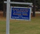
Roadside Park Consistency

Michigan has 80+ MDOT-maintained roadside parks and scenic turnouts, spanning both the Upper and Lower Peninsulas. They are found on state and US highways, and are seasonal, typically open Apr-Nov. Usually found at a scenic natural feature, they provide parking, and most provide toilet facilities and picnic areas. These are not Rest Areas(see the Rest Areas page). The State of Michigan maintains a list of MDOT roadside parks here.
Park Area Place
- Park (under Outdoors) should be set as the primary category. The Scenic Overlook category can be added, if appropriate.
- The proper name is the official MDOT name, found in the link in the opening paragraph.
- Example: "Michigamme Roadside Park"
- Include any other relevant info (such as "Closed during winter, only open Apr-Nov"), and a (concise) description using text from MDOT.
- Use www.michigan.gov/mdot for the website, and MDOT main contact for the phone number.
- Follow all other guidelines for Places.
Parking Lot Area
- A PLA can be mapped using the guidelines found on the Parking Lot page.
Road Segments
Roadside parks should use the PLR road type, with the "none" box check in the street name field. Generally, all roads in Michigan should have a city name associated with the segment, as all of Michigan is included in some sort of municipality. If you find a case where there is no city assigned to that area in WME, check with local leadership so the correct city can be seeded. Always verify with the city layer to prevent any city smudging (for info, check out the Smudged City page).