< Scripts
| This page is an element displayed as a section on the Scripts page. The content should be edited on this page, click here to view it on the main page. |
by EduardoCarvajal (PM [Help]) ![]() ; based on the script by aeytom (PM [Help])
; based on the script by aeytom (PM [Help]) ![]()


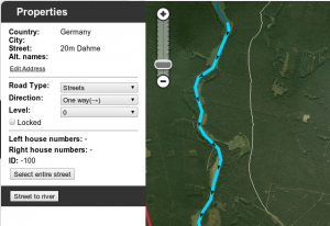
The script is designed as a helper for creating river landmarks for the free Waze navigation system. The script transforms the geometry of a new unsaved street to a river landmark. You can predefine the width and the name for the new landmark in the form of a special street name.
Mini how-to:
To add a new river:
- Install this script and go to WME.
- Draw a new street but do not save the street.
- Add and apply a street name to define the rivers name and width. This step is optional.
- Example: 20m Spree creates a 20 meters wide river named Spree
- Select the helper street.
- Click the Street to river button.
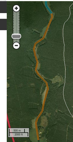
- Delete the helper street.
- Edit the new landmark as you like. You can even set the landmark to another type. Here it is used to mark a railroad, using landmark type 'other'.
To expand an existing river:
- Draw a new Street that starts inside an existing river, but do not save the Street.
- Make sure that you see on map the beginning of the Street (the intersection point of the street and the river)
- Select the helper Street.
- Click the "Street to river" button.
- Delete the helper Street.
- Edit the new landmark as you like.
Examples of rivers created by the script are Sixaola River and Telire River.
Multilingual interface: English, Spanish, Portuguese, French, Russian, Hungarian and Czech.
↓ DOWNLOAD ↓
| Bring up comments or questions on this page in this forum |