< Scripts
by bedo2991 (bedo2991 PM) ![]()

Motivation
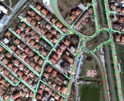
Current Waze road layer is generated on a Waze server and is just downloaded on the users' browsers. This script allows to locally generate a vector layer based on the Waze object model.
The layer is generated on the client side and therefore is fully customizable. Moreover it shows many more things than the standard layer, for example speed limits, road closures and segments' elevation.
Customization Panel
To open the script's settings, click on the attribution bar on the bottom left of the map. Don't forget to save before closing the panel, otherwise the changes will only have effect until you refresh the editor page.
↓ DOWNLOAD ↓
| Bring up comments or questions on this page in this forum |