Introduction
City Labelling in New Zealand has been evolving. This document has been created to try and set some standards.
City and County Naming
The City field should be used to specify the city, town or village for all the streets within it.
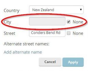
Rural roads that are in-between towns should be left with "No city".

Table
| Auckland | AUK | Manawatu-Wanganui | MWT | Taranaki | TKI |
| Bay of Plenty | BOP | Marlborough | MBH | Tasman | TAS |
| Canterbury | CAN | Nelson | NSN | Waikato | WKO |
| Chatham Islands | CIT | Northland | NTL | Wellington | WGN |
| Gisborne | GIS | Otago | OTA | West Coast | WTC |
| Hawke's Bay | HKB | Southland | STL |
Urban Areas
To aid in an easy to understand client display, if the street is visible at higher zoom levels (Primary and above) the City field should be used to only specify the city, town or village.
Example
Lets take Kamo, Whangarei as an example.
For all roads in the urban areas:
- Primary city: Whangarei
- Alt city: Kamo, Whangarei
Rural Areas
Excluding Motorways if a road is driven at open road speeds then it is classified as a rural road, and the Primary street details should have No City ticked, but an alternative name entered with the city which would be given in a postal address.
Example
Lets take a road on State Highway 3 as an example.
When travelling on the Open Road (e.g. when the speed limit is greater than 80 km/h):
- Primary city: No City
- Alt city: Hukerenui, Northland
When not travelling on the Open Road (e.g. when speed limit 80km/h or lower):