Residential Place
When arriving, Waze proposes to take a picture of your destination. In this way, many private Places are uploaded to WME. For these private Places, the category residential is used (RPP). Private Places will not be searchable, and the identity of whoever created them or attached pictures, will not be exposed. Private Places only contain photos and an exact address, without all the other properties of a Place. The pictures will only show to people driving explicitly to that address. Waze editors will be using the pictures and exact locations to improve the house numbers database.

Street names
If the street name from a residential place differs from the most nearby segment it may be an error. This situation can be detected by the WME Magic script.
These are the possible solutions:
- The street name of the most nearby segment is wrong.
- The RPP street name is wrong.
- One of those street names are wrongly spelled.
- The location of the RPP is wrong, perhaps to near to a side street.
It may be necesary to add an Entry/Exit point if:
- The street name is prefixed by a “Road number”, see Routing to matching Alternative Street names.
- The RPP is located on a Private Road or a Parking Lot Road without name.
WME layers

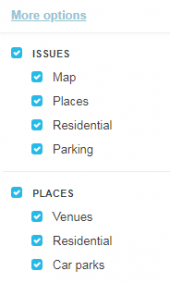
The displaying of residential places and residential place requests can be actived and deactivated via the WME in the layers menu.
See also
- The: Residential or private places paragraph on the Places page.
- The script WME House Numbers to RPP.