Verouderde vertalingen worden zo weergegeven.
BAG

- BAG stands for "Basisregistratie adressen en gebouwen".
- Information on all Dutch houses - streets and house numbers.
- Available via the BAG viewer: https://bagviewer.kadaster.nl.
- After selecting a house, address information is shown. (See picture)
- The BAG address information (Resultaat: street name and house number) are leading.
Remark: Don't use the BAG map for mapping roads.
Usage
This information can be used to add house numbers by adding the BAG map overlay via the OpenMap script.
Steps
- Install OpenMaps script (if not already done)
- WME left hand side area: click on the tab identified with

- Select a map to add: BAG
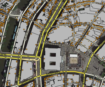
- Zoom in to level 18 or more and the information from BAG (houses pictured grey with yellow dots) is displayed.
- Display on another browser window the BAG viewer: https://bagviewer.kadaster.nl.
- Use the Resultaat information from the BAG viewer to add house numbers; add the house numbers on they yellow dots.
