(Created page) |
(Wikilinked) |
||
| Línea 1: | Línea 1: | ||
Figuring out if a street is one way or two way in [[Waze Map Editor]] (WME) has become much simpler with the addition of the embedded Google Street View (GSV). However this doesn't make the determination automatic as the streets themselves don't necessarily have proper signage or other features that ensure the street being viewed is definitively one way or two way. | Figuring out if a street is [[#REDIRECT [[Creating_and_Editing_street_segments#Set_Road_Type.2C_Direction.2C_and_Elevation]] | ||
|one way or two way]] in [[Waze Map Editor]] (WME) has become much simpler with the addition of the embedded Google Street View (GSV). However this doesn't make the determination automatic as the streets themselves don't necessarily have proper signage or other features that ensure the street being viewed is definitively one way or two way. | |||
Certainly the best method for determining a street's directional flow is by driving it, but it is not always easy or possible to drive every street being edited. The information below will provide alternate solutions to physically driving the roads. | Certainly the best method for determining a street's directional flow is by driving it, but it is not always easy or possible to drive every street being edited. The information below will provide alternate solutions to physically driving the roads. | ||
Revisión del 01:28 23 feb 2014
Figuring out if a street is [[#REDIRECT Creating_and_Editing_street_segments#Set_Road_Type.2C_Direction.2C_and_Elevation |one way or two way]] in Waze Map Editor (WME) has become much simpler with the addition of the embedded Google Street View (GSV). However this doesn't make the determination automatic as the streets themselves don't necessarily have proper signage or other features that ensure the street being viewed is definitively one way or two way.
Certainly the best method for determining a street's directional flow is by driving it, but it is not always easy or possible to drive every street being edited. The information below will provide alternate solutions to physically driving the roads.
Signs

Most signs cannot be seen from the Map Editor aerial view. Instead GSV is almost necessary, short of real world driving. In very few cases an aerial view may catch the shape of a stop sign, but it is of little value in sign determination.
One Way
The most recognizable sign is the normal black and white rectangular arrow sign, but there are others around that you should be aware of:
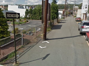

Begin One Way

One of the best signs for locating one way streets at the beginning of segments.
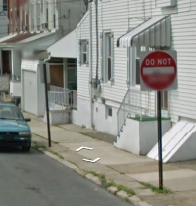
Do Not Enter

Typically square signs with a red circle and white lettering. Note that the cars are parked in the same direction on both sides of the street, indicating one way as opposed to "Don't enter the street this way."
A Do Not Enter sign doesn't always mean that the street beyond is necessarily one way. In some cases, the sign is there to prevent entry due to existing traffic conditions, but the street behind the sign can be itself two way. Double check other indications listed below to confirm. If you do see a Do Not Enter sign with two way traffic beyond, use turn restrictions instead of one way designations.
Stop

A stop sign on only one side of a street is an excellent indicator of a street NOT being one way. If you see parked cars facing the other way of the stop sign, the street is most definitely two way. Alternately a stop sign on the left side of the road facing oncoming traffic indicates a one way street for a right-hand drive country.
Mid-street Signage
On one way streets, the signage will face oncoming traffic. If there are no other ways of determining the street status, check to see if signs face different ways on both sides of the street. This is usually a reliable indicator of two way traffic.
Check Intersections First in GSV
Most identifying one way signs are located at intersections. Rather than using GSV to "drive" along the streets in question, move the viewer from one intersection to another to save time, before "driving" down the street to check for other indicators.
Painted Street Lines
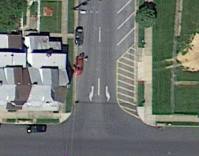
Arrows defining street direction are the best definitive indicators of street direction.

Painted street lines are readily visible in both satellite and GSV views. Gold single or double, dashed or solid lines are good indicators of two way roads, where white lines only, usually dashed, indicate one direction of travel.
Parked (or moving) cars
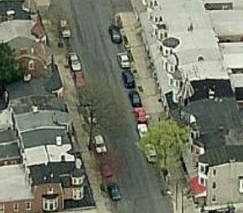
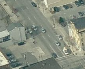
For either aerial or GSV perspectives, the direction that cars are parked are a good indicator of street flow direction. If all the cars face the same way on both sides of the street, you should be able to make the argument that the street is one way in that direction.
If only one side of the street has cars parked in the same direction, it could be restricted parking on the other side, which is not conclusive.
A moving car in GSV is usually conclusive for the street running in the direction of the moving car. It doesn't necessarily mean that it is One Way, however. Use more indicators before you determine for sure.
GPS points
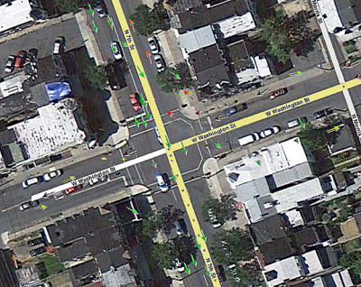
GPS points that have multiple arrows going in the same direction without opposing arrows is a decent indication of a one way street, but it is not conclusive. Again, use other more definitive ways of determining the direction first and use GPS points only to back up your findings.
Alleys
Alleys are typically narrow two way streets. Check for signs on the building walls or nearby fences. Many alleys in towns that have not been updated since they were created show them as default one way streets. Mostly, these are artifacts of when they were created and need to be updated.
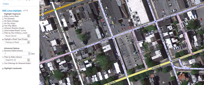
Use the One-Way Highlighter in WME Colour Highlights
Updating multiple one-way segments with WME
Be cautious of selecting multiple streets and making them one way because the direction they were created produces the A-B direction and some segments may need to be set for the opposite B-A one way direction.


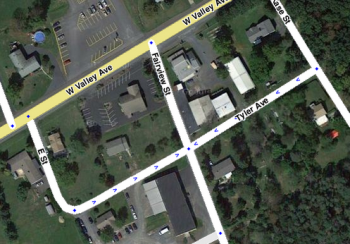
Real life example

Here is a real scenario to review the concepts above.
This intersection of an alley appears to be a one way street because of the Do Not Enter sign and the parked cars facing us on their left side of the street. There is an alley part way down this street. Normally, one way status doesn't change at an alley but it is better to "drive" to the next corner with GSV.

Half way up the block to the alley there is a parked car facing in the opposite direction and a street sign and stop sign pointed our way. There are no other signs indicating any one way condition except the Do Not Enter sign at our starting intersection. Putting all of this together, all indications are that the street is only one way up to the intersection of the first alley on the right.
Finally
In most cases, do not make a decision based on only one criterion. Use at least two to be definite. The best is a directional arrow street line, followed by the One Way sign, and then a Do Not Enter sign. Look for parked car directions and then the other ways. When all of them fail, default to Two-Way. If it for some reason happens to be really One Way, a UR or SR will probably show up alerting you to a possible error.
