If a road segment or landmark is within an incorporated place or CDP (census-designated place), use that name as the primary city name. There are several sources of this informationː
Install the WME Cities Overlay and be sure to check the box for Cities/Towns/CDP.
If the segment runs along the border between two Cities or CDPs, then the primary city name should be left blank and the "None" check box selected. The primary segment name should be duplicated in the alternates for both CIty/CDP names as well as the alternate segment names. Do not check "None" for any of the alternate city names. Example:Error creating thumbnail: Unable to save thumbnail to destination
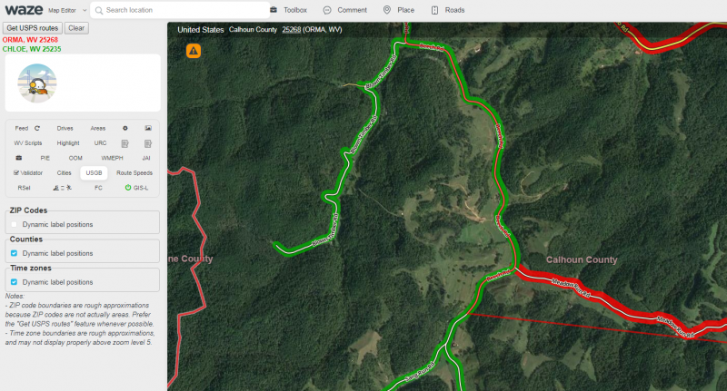
If the segment falls outside of a City or CDP, then the primary city name should be left blank and the "None" check box selected. The primary segment name should be duplicated in the alternates and all alternate names should use the USPS Zip Code City name. Do not check "None" for any of the alternate city namesError creating thumbnail: Unable to save thumbnail to destinationTo determine the correct alternate city name for segments outside City or CDP boundaries, it is highly recommended to use the USPS Routes function of the WME US Government Boundaries script. To do so, click the "Get USPS Routes" button added to WME by the script when the area you are working on is centered in the editor:Error creating thumbnail: Unable to save thumbnail to destinationThis will add highlights to the map indicating the city used for addressing on segments, with a key in the upper left of the editor. Example:To remove highlights, click the "Clear" button next to the "Get USPS Routes" button.
Freeways
If the road type is Freeway, set the city as None, regardless of the location. Be sure to also set the city name of any alternate names correctly. Please discuss any deviations from this guidance in the West Virginia Forum.
