mNo edit summary |
mNo edit summary |
||
| Line 4: | Line 4: | ||
===General=== | ===General=== | ||
The administrative division of India consist of 29 States and 7 Union Territories. These are used in the State address field in [[Waze Map Editor]]. | The administrative division of India consist of 29 States and 7 Union Territories. These are used in the State address field in [[Waze Map Editor]]. Each state can have his own rules on for instance maximum speed, since 2018 India has also a country wide [[Speed limit]] regulation. | ||
===States=== | ===States=== | ||
Revision as of 07:52, 19 April 2018
New India Wiki is being built, For now, please see the pages about Waze in India in the old Wiki.
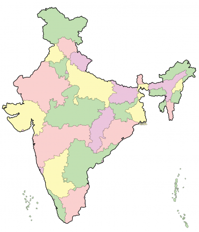
India States
General
The administrative division of India consist of 29 States and 7 Union Territories. These are used in the State address field in Waze Map Editor. Each state can have his own rules on for instance maximum speed, since 2018 India has also a country wide Speed limit regulation.
States

Andhra Pradesh
Arunachal Pradesh
Assam
Bihar
Chhattisgarh
Goa
Gujarat
Haryana
Himachal Pradesh
Jammu and Kasjmir
Jharkhand
Karnataka
Kerala
Madhya Pradesh
Maharashtra
Manipur
Meghalaya
Mizoram
Nagaland
Odisha
Punjab
Rajasthan
Sikkim
Tamil Nadu
Telangana
Tripura
Uttar Pradesh
Uttarakhand
West-Bengal