No edit summary |
No edit summary |
||
| Line 141: | Line 141: | ||
<u>'''Complément d'information'''</u> | <u>'''Complément d'information'''</u> | ||
: [http://www.waze.com/forum/viewtopic.php?t=35237 ''WME Junction Node Fixer'' sujet de discussion] sur le forum | : [http://www.waze.com/forum/viewtopic.php?t=35237 ''WME Junction Node Fixer'' sujet de discussion] sur le forum | ||
{{ | {{Collapsible section bottom}} | ||
{{Collapsible section top}} | |||
=== WME Toolbox === | |||
{{Collapsible section content}} | |||
Ce script ajoute de nombreuses possibilités d'éditions telles que le surlignage coloré de segments problématiques, la reconstruction de rond-points, la conversion de rond-points en route normale, la simplification de la géométrie des segments, etc. | |||
[[Extension:WME_Toolbox|<u>'''Consultez cette page dédiée à WME ToolBox'''</u>]] | |||
{{Collapsible section bottom}} | |||
[[Extension:WME_Toolbox|<u>''' | |||
{{Collapsible section top}} | |||
=== Roundabout Angles and Landmark === | === Roundabout Angles and Landmark === | ||
{{Collapsible section content}} | |||
Roundabout Angles and Landmark is a script with two features: | Roundabout Angles and Landmark is a script with two features: | ||
* selecting a roundabout node, on the left side there is a button to automatically create a "junction" landmark around the landmark. Roundabout segments shall not have street name set, but the roundabout name should be added to this landmark in the middle, so the label appears horizontally. | * selecting a roundabout node, on the left side there is a button to automatically create a "junction" landmark around the landmark. Roundabout segments shall not have street name set, but the roundabout name should be added to this landmark in the middle, so the label appears horizontally. | ||
| Line 198: | Line 165: | ||
<u>'''More information'''</u> | <u>'''More information'''</u> | ||
: [http://www.waze.com/forum/viewtopic.php?t=32633 ''Roundabout Angles and Landmark'' forum thread] | : [http://www.waze.com/forum/viewtopic.php?t=32633 ''Roundabout Angles and Landmark'' forum thread] | ||
{{Collapsible section bottom}} | |||
{{Collapsible section top}} | |||
=== WME Aerial Shifter (WAS) === | |||
{{Collapsible section content}} | |||
=== | |||
[[Image:WAS.jpg|right|link=]] | [[Image:WAS.jpg|right|link=]] | ||
This script helps you adjust the position of underlying satellite imagery to work on road alignment inside WME. Generally the GPS points layer will be displayed on the map at a location parallel to the visual roadway. Adjust the setting until the GPS points are aligned with the visual map. Different sections of the map may or may not have this same amount of misalignment, so it is best to use this same technique in other areas before you use the same offset as a prior area. | This script helps you adjust the position of underlying satellite imagery to work on road alignment inside WME. Generally the GPS points layer will be displayed on the map at a location parallel to the visual roadway. Adjust the setting until the GPS points are aligned with the visual map. Different sections of the map may or may not have this same amount of misalignment, so it is best to use this same technique in other areas before you use the same offset as a prior area. | ||
| Line 215: | Line 180: | ||
<u>'''More information'''</u> | <u>'''More information'''</u> | ||
: [http://world.waze.com/forum/viewtopic.php?t=53022 ''WME Aerial Shifter'' forum thread] | : [http://world.waze.com/forum/viewtopic.php?t=53022 ''WME Aerial Shifter'' forum thread] | ||
{{Collapsible section bottom}} | |||
{{Collapsible section top}} | |||
=== Street to River PLUS === | === Street to River PLUS === | ||
{{Collapsible section content}} | |||
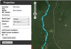
[[image:street-created-selected-and-named.png|thumb|Street created, selected and named]] | [[image:street-created-selected-and-named.png|thumb|Street created, selected and named]] | ||
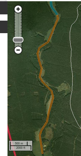
[[image:created-river-after-helper-street-deleted.png|thumb|River created and helper street deleted]] | [[image:created-river-after-helper-street-deleted.png|thumb|River created and helper street deleted]] | ||
| Line 257: | Line 220: | ||
: [http://www.waze.com/forum/viewtopic.php?f=819&t=87931 ''Street to River PLUS'' forum thread] | : [http://www.waze.com/forum/viewtopic.php?f=819&t=87931 ''Street to River PLUS'' forum thread] | ||
{{clear|right}} | {{clear|right}} | ||
{{Collapsible section bottom}} | |||
{{Collapsible section top}} | |||
===Road Type Calculator=== | ===Road Type Calculator=== | ||
{{Collapsible section content}} | |||
This is a calculator meant as an aid to classify roads, specially when faced with routing issues or difficulties on applying the current classification found on the wiki. | This is a calculator meant as an aid to classify roads, specially when faced with routing issues or difficulties on applying the current classification found on the wiki. | ||
| Line 274: | Line 237: | ||
: [http://crossrider.com/install/56884 ''Road Type Calculator'' main page] | : [http://crossrider.com/install/56884 ''Road Type Calculator'' main page] | ||
{{clear}} | {{clear}} | ||
{{Collapsible section bottom}} | |||
{{Collapsible section top}} | |||
===WME center to begin-end of street=== | ===WME center to begin-end of street=== | ||
{{Collapsible section content}} | |||
[[File:CenterOnA-B.png|300px|right]][[File:CenterOnA-B-Close.png|border|right]] | [[File:CenterOnA-B.png|300px|right]][[File:CenterOnA-B-Close.png|border|right]] | ||
The script adds the ability to center the map at the beginning or end of the currently selected segment. The ends are selected with the '''A''' and '''B''' buttons. The script also remembers the last map position and zoom level before pressing either '''A''' or '''B'''. That feature is accessed with the '''return''' button. The '''X''' button will clear the last map position until '''A''' or '''B''' is pressed again (setting a new remembered map position). | The script adds the ability to center the map at the beginning or end of the currently selected segment. The ends are selected with the '''A''' and '''B''' buttons. The script also remembers the last map position and zoom level before pressing either '''A''' or '''B'''. That feature is accessed with the '''return''' button. The '''X''' button will clear the last map position until '''A''' or '''B''' is pressed again (setting a new remembered map position). | ||
| Line 288: | Line 250: | ||
<u>'''More information'''</u> | <u>'''More information'''</u> | ||
: [http://www.waze.com/forum/viewtopic.php?f=819&t=83820 ''WME center to begin-end of street'' forum thread] | : [http://www.waze.com/forum/viewtopic.php?f=819&t=83820 ''WME center to begin-end of street'' forum thread] | ||
{{Collapsible section bottom}} | |||
== | == Vérification de la cartographie et Navigation == | ||
=== WME Route Tester=== | Les scripts ci-dessous apportent de nombreuses fonctions de vérification de la cartographie (présence d'erreurs ou de non-conformité par rapport aux usages d'édition convenu par la communauté) et des fonctions destinées à vérifier la Navigation. | ||
{{Collapsible section top}} | |||
=== WME Route Tester=== | |||
{{Collapsible section content}} | |||
This script allows you to see the current navigation instructions in the editor. Simply select two segments, and click on the Routes tab that appears on the left. | This script allows you to see the current navigation instructions in the editor. Simply select two segments, and click on the Routes tab that appears on the left. | ||
| Line 303: | Line 270: | ||
<u>'''More information'''</u> | <u>'''More information'''</u> | ||
: [http://www.waze.com/forum/viewtopic.php?f=819&t=64777 ''WME Route Tester'' forum thread] | : [http://www.waze.com/forum/viewtopic.php?f=819&t=64777 ''WME Route Tester'' forum thread] | ||
{{Collapsible section bottom}} | |||
{{Collapsible section top}} | |||
=== WME Validator === | === WME Validator === | ||
{{Collapsible section content}} | |||
This script validates a map area in Waze Map Editor, highlights issues, and generates a [http://www.waze.com/forum/viewtopic.php?f=819&t=76488&start=110#p671943 very detailed report] with wiki references and how-tos. | This script validates a map area in Waze Map Editor, highlights issues, and generates a [http://www.waze.com/forum/viewtopic.php?f=819&t=76488&start=110#p671943 very detailed report] with wiki references and how-tos. | ||
| Line 330: | Line 295: | ||
:[http://www.waze.com/forum/viewtopic.php?f=819&t=76488&p=666476#p666476 ''Validator'' FAQ and forum thread]. | :[http://www.waze.com/forum/viewtopic.php?f=819&t=76488&p=666476#p666476 ''Validator'' FAQ and forum thread]. | ||
{{Collapsible section bottom}} | |||
== WME | == Messagerie Instantanée WME == | ||
Les scripts ci-dessous apportent de nombreuses fonctions à l'utilisation de la messagerie instantanée (le ''Chat'') intégré dans l'interface WME. | |||
{{Collapsible section top}} | |||
=== WME Chat addon === | === WME Chat addon === | ||
{{Collapsible section content}} | |||
<!-- The text for this section is transcluded from [[WME Chat#WME Chat addon]] please make any changes there. --> | <!-- The text for this section is transcluded from [[WME Chat#WME Chat addon]] please make any changes there. --> | ||
{{:Waze Map Editor/Chat|transcludesection=WME_chat_addon}} | {{:Waze Map Editor/Chat|transcludesection=WME_chat_addon}} | ||
{{Collapsible section bottom}} | |||
{{Collapsible section top}} | |||
=== WME Chat Jumper === | === WME Chat Jumper === | ||
{{Collapsible section content}} | |||
<!-- The text for this section is transcluded from [[WME Chat#WME Chat Jumper]] please make any changes there. --> | <!-- The text for this section is transcluded from [[WME Chat#WME Chat Jumper]] please make any changes there. --> | ||
{{:Waze_Map_Editor/Chat|transcludesection=WME_chat_jumper}} | {{:Waze_Map_Editor/Chat|transcludesection=WME_chat_jumper}} | ||
{{Collapsible section bottom}} | |||
== Bookmarklets == | == Bookmarklets == | ||
Several very useful [http://en.wikipedia.org/wiki/Bookmarklet bookmarklet] scripts have been developed to enhance the map editing process. A complete list of available scripts are on the [[Bookmarklets]] Wiki page along with instructions on how to add them to your browser. | Several very useful [http://en.wikipedia.org/wiki/Bookmarklet bookmarklet] scripts have been developed to enhance the map editing process. A complete list of available scripts are on the [[Bookmarklets]] Wiki page along with instructions on how to add them to your browser. | ||
== Developing scripts == | == Developing scripts == | ||
Please see [[WME JavaScript development]]. | Please see [[WME JavaScript development]]. | ||
Revision as of 12:15, 2 October 2014
WIP (WORK IN PROGRESS)
Traduction / Simplification / Adaptation FR de la page US
Community Plugins, Extensions and Tools
Extensions, Plugins et Outils de la communauté
La communauté Waze a créé un certain nombre d'outils d'aide à l'édition ou à l'usage sous la forme d'extensions à utiliser dans les interfaces web de Waze.
| Ces scripts requièrent des mises à jour régulière pour fonctionner correctement, en particulier suite à une publication d'une mise à jour des produits Waze tel que l'éditeur ou l'application cliente. Certains scripts se mettent à jour automatiquement dès que leur auteur les modifient, tandis que d'autres nécessitent une mise à jour manuelle de votre part |
Améliorations de l'affichage sur WME
Les scripts ci-dessous apportent de nombreuses informations utiles à l'éditeur par le biais un affichage complémentaire directement dans l'interface web de WME.
Édition de la carte
Les scripts ci-dessous apportent de nombreuses fonctions d'aide à l'édition, en donnant accès à des fonctionnalités interne de WME ou en automatisant certaines tâches complexes ou fastidieuses.
Les scripts ci-dessous apportent de nombreuses fonctions de vérification de la cartographie (présence d'erreurs ou de non-conformité par rapport aux usages d'édition convenu par la communauté) et des fonctions destinées à vérifier la Navigation.
Messagerie Instantanée WME
Les scripts ci-dessous apportent de nombreuses fonctions à l'utilisation de la messagerie instantanée (le Chat) intégré dans l'interface WME.
Bookmarklets
Several very useful bookmarklet scripts have been developed to enhance the map editing process. A complete list of available scripts are on the Bookmarklets Wiki page along with instructions on how to add them to your browser.
Developing scripts
Please see WME JavaScript development.


