KISS As simple as possible, as complex as necessary
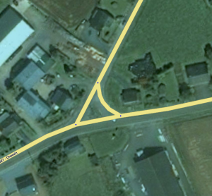
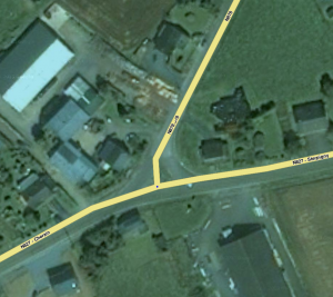
KISS is keeping the road geometry as simple as possible, without losing the essential driving instructions.
There is one important thing to always keep in mind when you edit the map: Waze is not a topographic map, but a navigation system! Over the years, the community discovered ways to edit the map in a way that maximizes navigation. Waze relies on a map’s display suitable for a small smart-phone screen. It needs a map that accurately instructs where cars can drive, is simple and clear, and uses real time traffic data bound to the parts on the map. Therefore, we follow the three basic principles "Usability, Simplicity, & Retention"; Make it useful, keep it as simple as possible. See also the global page on Best map editing practise
What ʔ
What is this KISS all about? Summarized: "As simple as possible, as complex as necessary". In short statementsː
- Simplify the map and segments as far as possible
- Make situations only as complex as needed
- Use segments only for routing, not for something like lane assistance.
- Segments doesn't have to have the exact metres of paved road.
Why ?
Why do we apply KISS? There are several reasonsː
- The available resources are limited, we have to use them in a optimal way. Each segment, each node, is data, consumes space and takes time to process, transmit,
- Besides limiting the amount of data, it is important to limit the amount of caculations the routing server has to make. How more Junction Nodes, Turning Restrictions there are, how more routing possibilities there are to check before the best route can be presented. Summarizedː "less is more".
- How greater the number of segments, how less clear the map will be. In the WME it is possible to zoom-in and zoom-out, in the app this is difficult. We choose for a clear and simple map.
- The GPS-receivers in our smartphones and tablets are still not precise enough to detect on which of two or more adjacent lanes we drive. The road types will get some extra attributes if lane assitance will be realized.
When ?
KISS is a principle. It is not about when , but we always apply the principle.
The following situations can but doesn't have to lead to road separationː
- There is a concrete road separation.
- There is a green zone between the two driving directions, the two driving directions are separated.
It is not easy to formulate simple and clear rules to describe which situations can be simplified for how far. We try to give some guidelinesː
- If you're looking in the WME at the GPS-tracks of the two driving directions on zoom level 5 (100 m / 200 ft) and you don't see a clear separation than the road should by simplified to one two directions road instead of two separated one directions roads.
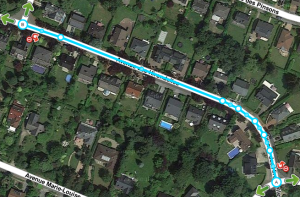
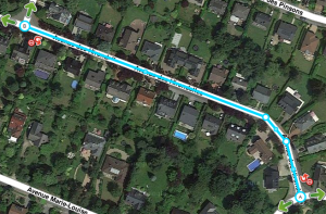
- Merge segments into one segment when there is no real added value to have more segments in terms of navigating and routing.
Examples
1-Reduce the number of nodesː
2-Simplify the crossingː
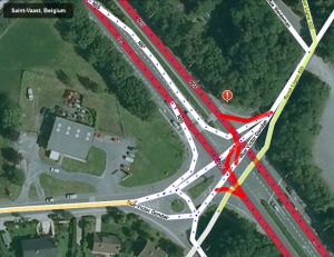
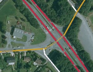
3-No need for separate roadsː

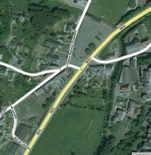
4-Applying a roundaboutː
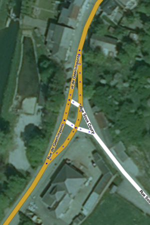

5-Clearing the crossingː

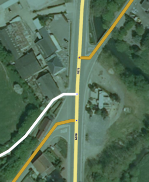
6-Simplifying the crossing
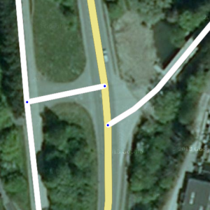
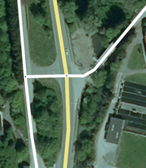
7-Just a T-crossingː
